
POINTS OF INTEREST
Overland Trail
Established
by “Stagecoach King” Ben Holladay on orders from the U.S. Post Office
Department, the Overland Trail carried nearly 20,000 emigrants a year west
between 1862 and 1868. During that time, the trail was the only route on which
the U.S. government would allow travel due to continuing Indian uprising
conflicts on the Oregon Trail.
Today, you can follow the historic route along Interstate 80, traveling across
the high grassland of the Laramie Plains and around the north shoulder of Elk
Mountain. At Arlington on Rock Creek, you can see one of the oldest standing log
cabins in Wyoming.
Medicine Bow-Routt National Forest
The Medicine Bow-Routt National Forests extend from north central Colorado to central Wyoming. The Forests encompass portions of many mountain ranges including the Gore Range, Flat Tops, Parks Range, Medicine Bow Mountains, Sierra Madre, and Laramie Range. The Forests provide year-round recreation opportunities for thousands of people. They also provide wildlife habitat, timber, forage for livestock, and are a vital source of water for irrigation, domestic use, and industry.
The topography varies greatly within the Forests due to the large geographic area encompassed. Elevations range from 5,500 feet to 12,940 feet. The climate of the Forests ranges from semi-arid at low elevations to cold and humid in the high country. Frost may occur at any time, and visitors to the higher elevations should be prepared for harsh weather, including snow and high winds, even during the summer months. Different districts administer different areas of each forest. References to these districts appear on a map and in sections of this guide. For more information, please contact us.
The Thunder Basin National Grassland is located in northeastern Wyoming in the Powder River Basin between the Big Horn Mountains and the Black Hills. The Grassland ranges in elevation from 3,600 feet to 5,200 feet and the climate is semi-arid. The Grassland provides unique opportunities for recreation, including hiking, sightseeing, hunting, and fishing. There are no developed campgrounds; however, camping is allowed. The Grassland abounds with wildlife year-round, provides forage for livestock, and is underlain with vast mineral resources. Land patterns are very complex because of the intermingled federal, state, and private lands. The Douglas Ranger District administers the Grassland.
There are 10 designated Wilderness Areas on the Forest, approximately 1360 developed sites, 2 ski areas (the Steamboat Springs Ski Area has worldwide acclaim), 162 recreational homes with Forest Service permits, and eight mountain lakes with developed boating facilities. On the combined Medicine Bow-Routt National Forests, downhill skiing and general winter sports are the most popular activities, followed by mechanized travel (including driving, OHV, boating, and bicycling), camping and developed site uses, hunting, and then fishing.
Army Forts in Carbon County
Fort Fred Steele
Established June 30, 1868 on the North Platte River, about fifteen miles east of what is now Rawlins, Wyoming at the point where the Union Pacific Railroad crossed the river.
Built by Major Richard I. Dodge, 30th U.S. Infantry and named for Colonel Frederick Steele, 20th U.S. Infantry who died on January 12, 1868.
Abandoned in 1886 and transferred to the Interior Department in August 1886.
Fort Halleck
Established July 20, 1862 at the base of Elk Mountain and west of the Medicine Bow River.
Built by Major John O'Ferrall, 11th Ohio Cavalry.
Named for Major General Henry W. Halleck.
On December 31, 1864 the following companies were listed as able and "in the saddle"(1):
One company of the 11th Ohio Cavalry
Abandoned July 4, 1866 and transferred to the Interior Department in October 1886.
Visitors Guide - Wyoming Travel Information
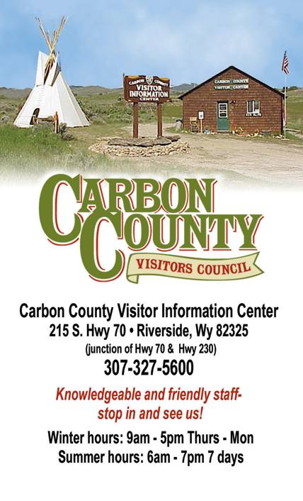
The Carbon County Visitors Counsel is located in Riverside, Wyoming off HWY 70. Click on the picture for more information on things to do in Carbon County.